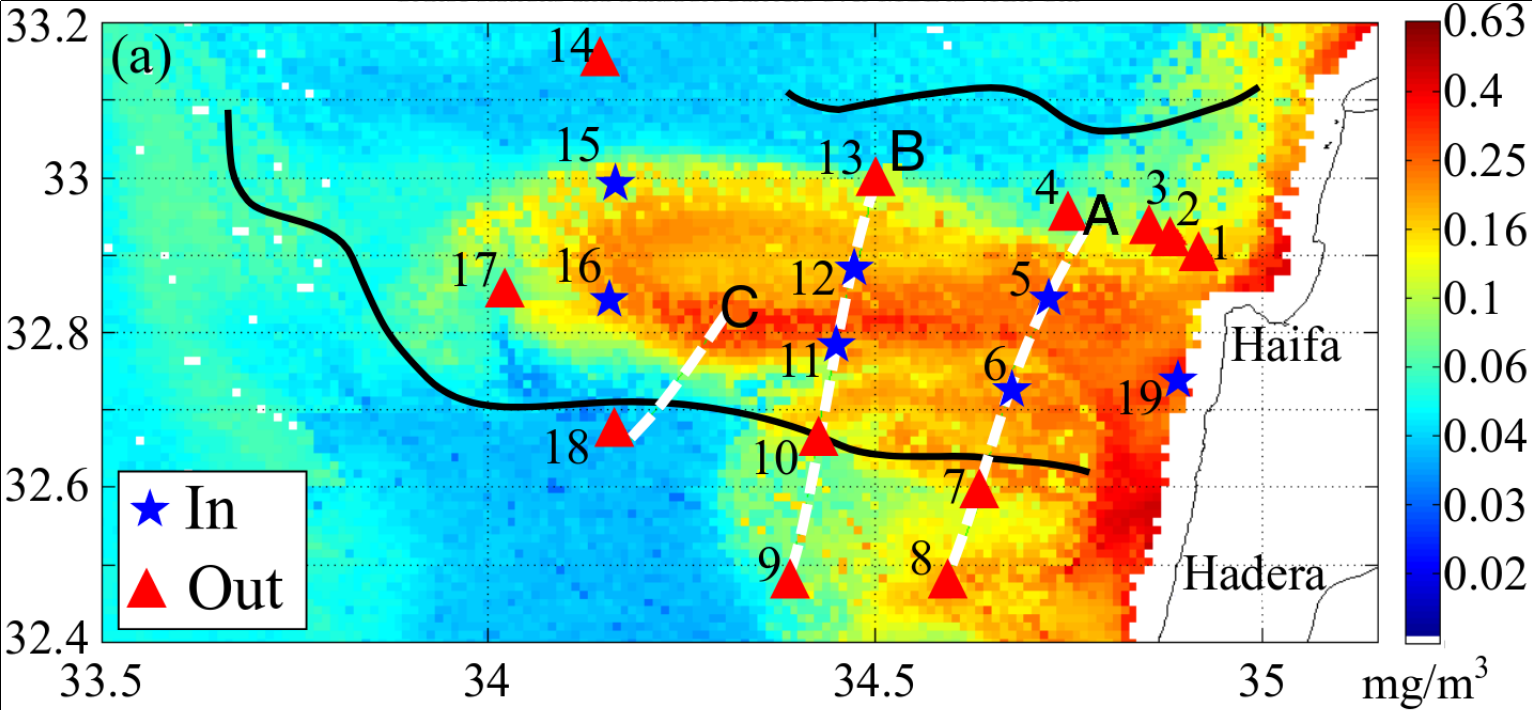
 Sea surface chlorophyll-a associated with the intrusive patch observed on 22 August 2011.
Intrusion of coastal waters into the pelagic Eastern Mediterranean: in situ and satellite-based characterization
Abstract
A combined dataset of near-real-time multi-satellite observations and in situ measurements from a high-resolution survey is used for characterizing physical-biogeochemical properties of a patch stretching from the coast to the open sea in the Levantine Basin (LB) of the eastern Mediterranean (EM). Spatial analysis of the combined dataset indicates that the patch is a semi-enclosed system, bounded within the mixed layer and separated from ambient waters by transport barriers induced by horizontal stirring. As such, the patch is characterized by physical-biogeochemical properties that significantly differ from those of the waters surrounding it, with lower salinity and higher temperatures, concentrations of silicic acid and chlorophyll a, and abundance of Synechococcus and picoeukaryote cells. Based on estimates of patch dimensions (∼40 km width and ∼25 m depth) and propagation speed (∼0.09 m s−1), the volume flux associated with the patch is found to be on the order of 0.1 Sv. Our observations suggest that horizontal stirring by surface currents is likely to have an important impact on the ultra-oligotrophic Levantine Basin ecosystem, through (1) transport of nutrients and coastally derived material, and (2) formation of local, dynamically isolated niches. In addition, this work provides a satellite-based framework for planning and executing high-resolution sampling strategies in the interface between the coast and the open sea.